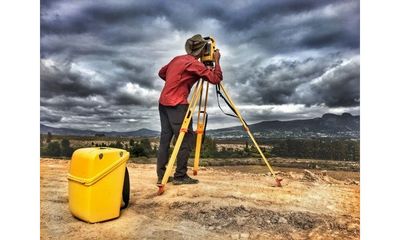
About Us
We have served the Houston area for over 12 years and work with title companies, realtors, builders and individuals to provide high quality land surveys. Overland Surveyors utilizes the latest technology to bring our customers accurate and graphically appealing surveys. We pride ourselves on reliability and being the fastest turn around time in Houston. In an industry where time is of the essence, our competitors can't match our typical 2 business day turnaround. Overland has multiple crews to service the Houston area as well as 4 Registered Professional Land Surveyors (RPLS). We conduct residential surveys, commercial surveys and elevation certificates throughout Houston and surrounding areas.
what kind of survey do you need?
RESIDENTIAL SURVEYS
- Residential surveys are usually requested by title companies, banks, and mortgage lenders. They confirm there has been no encroaching by an adjacent property owner and all permanent structures on the property are identified. They show that easements remain accessible and provide other data.
TOPOGRAPHY SURVEYS
- These are needed when adding a new structure onto a developed piece of land and will identify the contours and elevations. It shows where the property may need to be leveled, and help plot the surface for work visualization and planning in three dimensions.
FORM SURVEYS/ENVELOPE SURVEYS
- We can assist in the building process with envelope surveys which include the flagging of the corners of setbacks and easements to identify all buildable space. Form Surveys show the location (and elevations if requested) of the forms as they relate to the boundary.
TREE SURVEYS
- Tree surveys are performed on private or public landscapes. The goal of the survey is to provide useful information on the trees so that property managers or homeowners can make informed decisions. These are often done in conjunction with a topo survey.
ELEVATION CERTIFICATES
- EC's are used to gather elevation data for the purpose of accurately assessing flood risks to structures located in Flood Hazard Zones. We also offer the more detailed FIS (500 year study). These can also be used in areas to establish BFE if FEMA has not yet done so.
COMMERCIAL /ALTA / NSPS SURVEYS
- These are typically used for commercial real estate, showing existing improvements on a site relative to its boundaries as you see them on the deed. They also show improvements, easements, rights-of-way, zoning classifications, waterfronts, and much more.